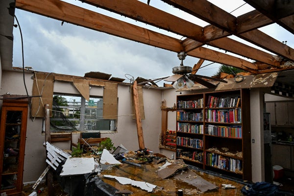
Hurricane Milton slammed into Florida as a Category 3 storm, bringing serious storm surge and drenching rains to the middle of the state. Given that discussions of the hurricane’s dangers had focused on flooding, rainfall and heavy winds, residents farther south were surprised to receive a barrage of tornado warnings—more than 100, all told—from local National Weather Service offices.
But Hurricane Milton’s sheer power and size had combined with underlying atmospheric factors to trigger dozens of tornadoes in what Jana Houser, an atmospheric scientist at the Ohio State University, calls “almost a perfect storm scenario with Milton.”
Whether within a hurricane or independently, tornadoes develop when rotating air near the ground is pulled upward in the atmosphere by a thunderstorm, Houser says. The air builds speed as it moves in and up.
On supporting science journalism
If you're enjoying this article, consider supporting our award-winning journalism by subscribing. By purchasing a subscription you are helping to ensure the future of impactful stories about the discoveries and ideas shaping our world today.
In general, tornadoes are particularly likely to occur in larger hurricanes such as Milton, which contained tropical-storm-force winds up to 255 miles from its core late on October 9.
Hurricanes have their own rotating winds, particularly in the eye wall at a hurricane’s core, where wind speeds are highest. Sometimes weak tornadoes can form near the heart of a hurricane right as it makes landfall, as the winds adjust to interacting with rough land rather than the relatively smooth ocean surface.
But that’s not where to look for stronger tornadoes, such as those spawned by Milton, which Stephanie Zick, a meteorologist at Virginia Tech, says were “particularly strong” for hurricane-generated tornadoes. Those form at the storm’s edges, in the strong outer rain bands as much as 100 miles from the eye, where supercell thunderstorms—large thunderstorms that rotate—thrive. In addition, Houser says that the environment Milton swirled into was conducive to tornado formation, thanks to the presence of pockets of warm, moist air and a band of winds that the storm could tap into.
Tornado conditions were also strongest on the east side of the storm, Zick says. When combined with distance from the hurricane’s eye, this placed the majority of tornado reports in southern Florida.
Despite the stir its tornadoes have caused, Milton wasn’t the hurricane that produced the most tornadoes this year, Houser says. That dubious honor goes to Hurricane Beryl, which struck the Gulf Coast of Texas in early July before trekking northeast across the U.S., with its remnants eventually drenching Vermont. Beryl spawned 68 tornadoes, Houser says—nearly twice Milton’s preliminary tally of 38. (Evaluating tornado reports and picking out duplicate or false alarms takes time, she notes.) The record hurricane for tornado production was Hurricane Ivan, which circled around the southeastern U.S. in September 2004 and triggered 120 tornadoes.
Hurricane-generated tornadoes are a striking example of the way hurricanes pose multiple threats to residents: not just vicious winds but also violent storm surge; not just a long deluge but also an abrupt tornado.
And sometimes the threats are connected. As Milton approached Florida, it ran into chaotic winds that tore at its structure, weakening the storm from a Category 5 with sustained winds of 160 miles per hour down to a Category 3 with winds around 120 miles per hour at landfall. But that also caused the storm to grow in size and created messier wind patterns at its edges, which fed the burst of tornadoes, Houser says.
“If those winds hadn’t been there, Milton probably would have made landfall as a Category 5 hurricane,” she says. “But then you probably wouldn’t have gotten nearly the amount of tornadoes that you ended up seeing further inland.”
